Active Logging
Updated: February 2025
There are no current harvesting operation in the Alberni Valley Community Forest.
We plan to start harvest activities Early Summer or Late Fall 2025
Update: September 2023
Alberni Valley Community Forest will be harvesting on Ash 9 which is close to the old Sproat Lake Forestry tower site. The harvesting will not impact the Teodoro trail area but will be on the old logging road that some people used to access the hiking trails. Logging trucks will be hauling logs down Weiner Main to Highway 4. Harvesting will start late September and run into December weather permitting. Please drive with caution and do not cross the signs which will be posted indicating hazards.
Map of Ash 9 Harvesting Area (pdf)
Update: May 2022
Bookhout Creek
Bookhout Creek area. AVCFC is currently harvesting four small blocks in the Bookhout Creek area. The access road has active hauling signs posted. The harvesting should be completed late May or Early June 2022.
Map of Bookhout Creek Harvesting Area (pdf)
South Taylor Main
South Taylor Main Klitsa Creek area. AVCFC is currently harvesting one block on South Taylor Main at the 18 km mark. South Taylor Main is a Forest Service Road and will be open to public for the duration of the harvesting period. There may be slight delays to the general public when harvesting is taking place adjacent to the main line. The harvesting should be completed late May or Early June 2022. Active hauling signs will be placed at the entrance to South Taylor Main from Highway 4 when hauling commences.
Another small block is planned for harvesting September 2022 at the 17 km mark on South Taylor Main.
Map of South Taylor Main Harvesting Area (pdf)
Update: January 2021
Bookhout Creek area. AVCFC is currently harvesting three blocks in the Bookhout Creek area. The access road has signs indicating active hauling. The harvesting and log hauling should be complete by end of February.
Map of Bookhout Creek Area Harvesting (pdf)
Weiner Creek area. Road construction and road right of way tree falling is happening on the Weiner Connector road across from Sproat Lake Landing. Some of the Weiner Creek trails and Teodoro Trails will be closed when rock blasting or tree falling is taking place. Signs will be placed at trail heads warning hikers not to enter trails. Signs will be current and removed as soon as it is safe to enter area. Please do not pass warning signs requesting trail users to not enter area.
Map of Weiner Creek Area Harvesting (pdf)
Update: June 2020
Currently, there is no active logging in the Alberni Valley Community Forest. Harvesting is planned to commence in the fall of 2020. There are some silviculture and planning activities but these activities should not pose a hazard to the general public.
Update: May 2019
Friesen Main Area. Harvesting operations are currently active on Friesen Main. This road is gated due to Ministry of Transportation requirements. Public access is restricted on this road system and the gate could be locked at any time. Hauling should be starting soon with completion time scheduled for mid June if the weather cooperates.
Taylor Branch 552 area.
There is active falling above the trail to Mount Klitsa that passes First and Second Lake. Falling could be happening weekdays and weekends so the trail is closed for public safety. Hauling down branch 552 will start later in the summer. Once falling is completed the web page will be updated to let public know when the trail will reopen.
Sproat Lake West Bay area.
A private land owner is harvesting land adjacent to the community forest and they will be hauling logs on the Weiner Connector road across from Sproat Lake Landing. Hauling should be completed by end of June.
Cutblock TS2 Overview Map
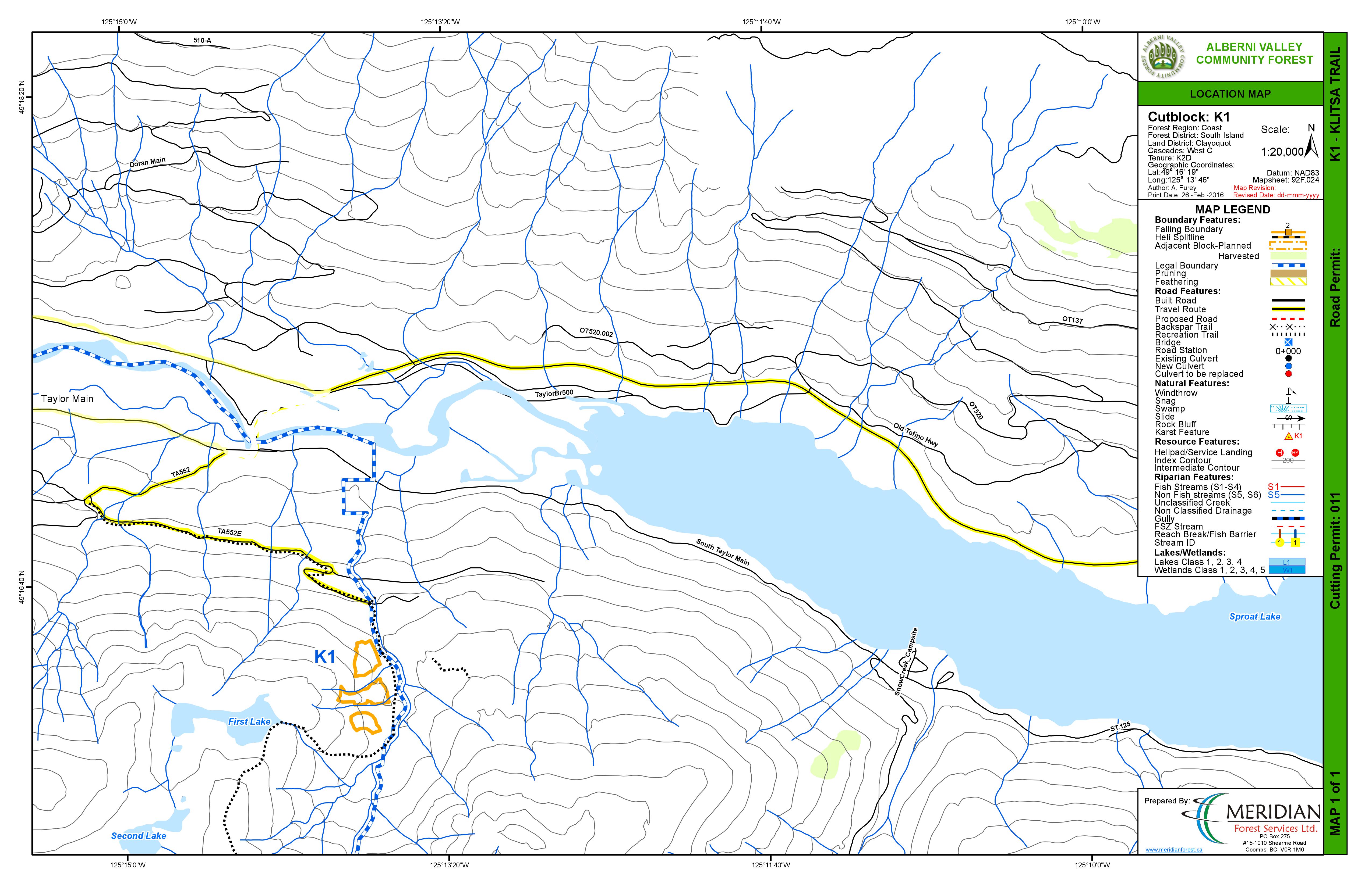
Cutblock K1 Overview Map
Update: November 2017
There is no active logging or hauling in the Alberni Valley Community Forest now. Harvesting activities will resume in the Taylor area in the spring of 2018.
Update: July 2017
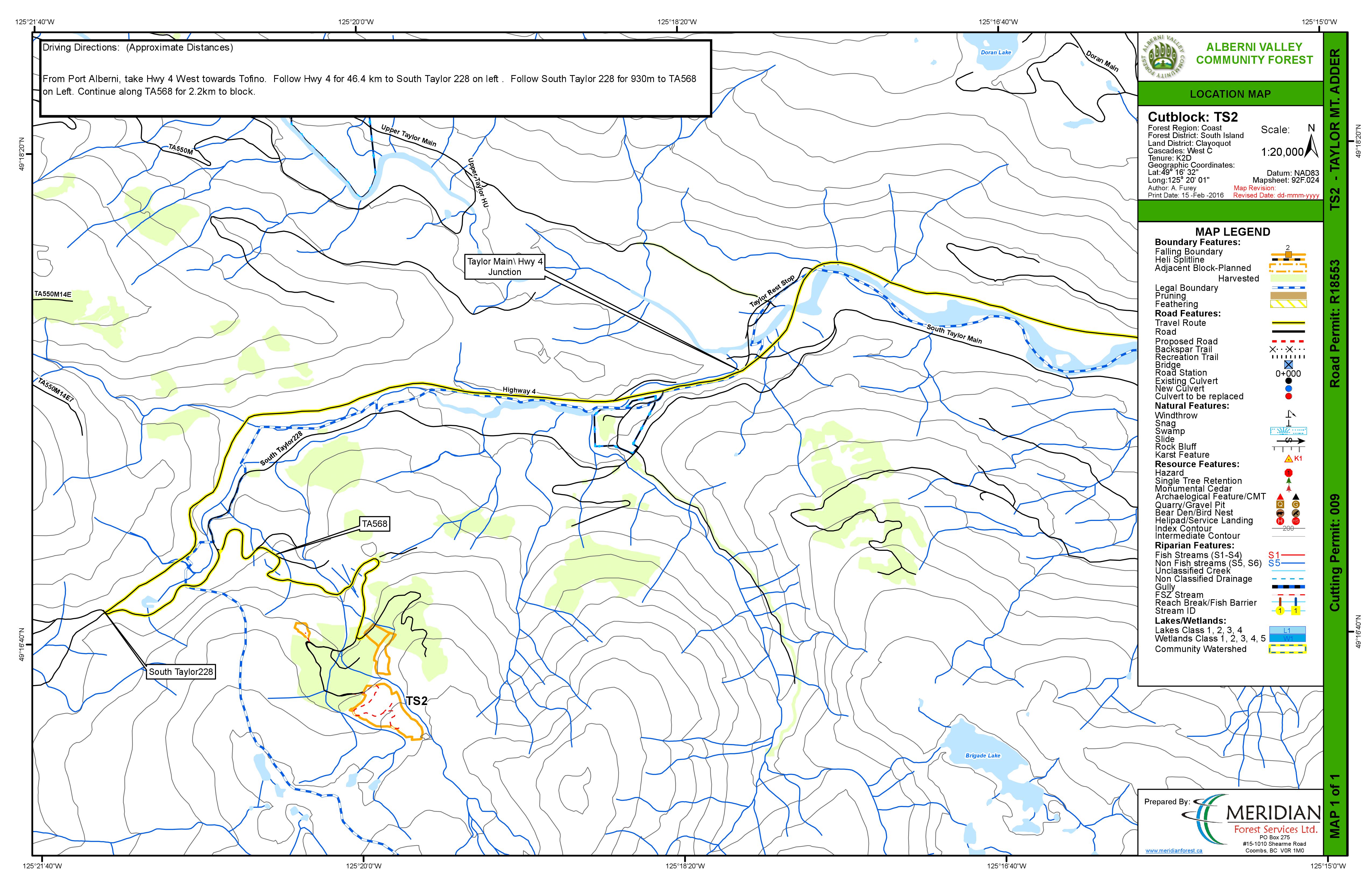
Taylor Sutton Pass area
Road building is on going in this area, in blocks 1 and TS2, but activity is dependent on fire hazard. Harvesting will start this summer or fall, but activity is also dependent on fire hazard.
Bookhout Creek and Weiner Creek
All harvesting operations for 2017 are complete in these areas. Once fire hazard is lower in late summer or fall there will be firewood cutting options in these areas. Check the Firewood tab in the Menu for updates.
Update: September 2016
Bookhout Creek and Weiner Creek
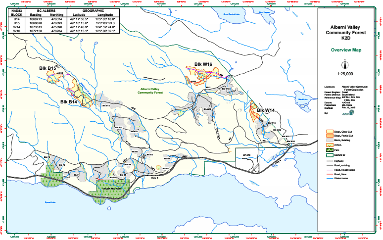
Harvesting is complete in blocks B14, B15 and B16 but not in W14. Harvesting will be complete in W14 by end of September. There will be some road deactivation and slash piling in these blocks. At present no firewood cutting is allowed in these blocks.
Taylor Sutton Pass area - Overview Map
Road building and harvesting will be starting this week in the Sutton Pass portion of our Taylor blocks. Taylor 568 which accesses the Adder Mountain Trail will be active with logging trucks and may be blocked while blasting for road construction. The industrial operations should be confined to week days but drive with caution and obey signs on weekends also in case plans change.
Block 1 Overview Map
Block TS2 Overview Map
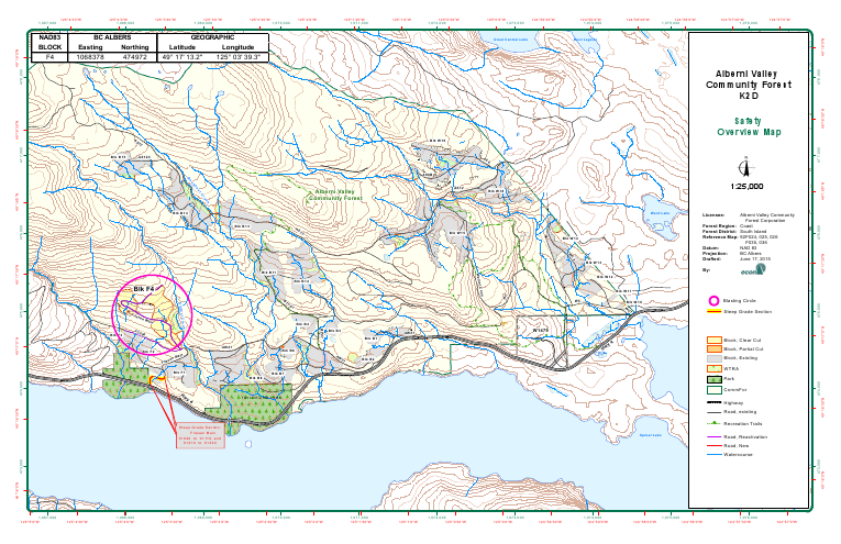
Update: April 2016
Bookhout Creek and Weiner Creek Overview Map
Harvesting is just starting in W14. Harvesting is just wrapping up in B14, B16 and W16. We hope to get waste and residue done soon so these block can be opened for firewood cutting. At present no firewood cutting is allowed in these blocks.
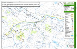
Friesen Creek Overview Map
Harvesting is still active in F4. At present no firewood cutting is allowed in these blocks.
Update: December 2015
BookhoutCreek and Weiner Creek Overview Map
Harvesting is still active in blocks B14 and B16. Harvesting has started in W16 and could start any day in W14 if the snow accumulates in the higher blocks.
Friesen Creek Overview Map
Harvesting has started in block F4.
Update: September 2015
Harvesting has started in blocks B14 and B15. For public safety Ash 12 will be closed in the day during working hours for next three months as all falling is close to road. Click on map below for location.